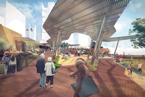
An example: Yagan Square at Perth City Link.
Council has endorsed a Community Spaces Strategy for the areas under and along the elevated rail between Hughesdale and Clayton, after consulting with the local community.
Council is a member of the Community Open Space Expert Panel established by the State Government to make recommendations to the government, and we are using our strategy to advocate for the best possible community outcomes.
Here is the City of Monash Community Spaces Strategy:
Introduction and General Principles(PDF, 678KB)
Part 1: Hughesdale Station(PDF, 3MB)
Part 2: Linear Corridor(PDF, 2MB)
Part 3: Clayton Precinct(PDF, 4MB)
Aerial Maps:
To get a feeling for available space under the structure (at both Hughesdale and Clayton), please refer to the aerial maps available on the Level Crossing Removal Authority’s website: bigbuild.vic.gov.au/projects/level-crossing-removal-project
So far, Council’s advocacy has resulted in some positive outcomes including:
- a preliminary concept for the area west of Clayton Rd includes Council’s suggestions for independent segments of urban play, intergenerational play, flexible space, and social interaction activities;
- Activity areas have been identified for east and west of Centre Rd in Clayton, including a multi-purpose sports court area.
In Hughesdale, Council is seeking enhancements in Galbally Reserve, to include more play areas and shelter, and screening planting along the complete northern side of the rail reservation behind property fences.
Council is also continuing to advocate strongly for an upgrade of the full length of the 17km shared cyclist/pedestrian path from Caulfield to EastLink, and for lighting along this path.
The Level Crossing Removal Authority is looking to remove the third rail track at Oakleigh to provide space for the shared path from Richardson St to the pedestrian underpass at Oakleigh Station. Council is concerned that the head clearance of the underpass is too low and the access ramps are too narrow and steep for this to be a safe thoroughfare for cyclists and pedestrians. We will continue to advocate for a safer and more practical route.
Through our community consultation, we know it is important to the local community that the areas under and along the elevated rail be maintained to a high standard, to guard against graffiti and other anti-social behaviour. The State Government has committed $15 million so far while discussions on the future maintenance arrangements continue.
Enquiries: Terry Tillotson, Principal Transport Engineer - LXRA Project, on 9518 3439.